Halls Creek
Halls Creek is not the town it used to be. This is true both literally and metaphorically as, in 1948, the town was physically removed from its original site to its present location so now there are two Halls Creeks.
In 1948 the town began its movement from Old Halls Creek, 15 km away, to the present site. This process continued until the old township was finally abandoned in 1954. The reasons for the change of location were a combination of lack of water and a re-routing of the main Derby-Kununurra Road to avoid winding through the hills around the old town.
The town’s movement was vital for its survival. It had come into existence as a gold mining town and with the gold now gone it was nothing more than a service centre for the surrounding pastoral holdings and the traffic which moved along the highway. If it did not move with the highway then its survival was in jeopardy.
Accommodation in Halls Creek
Old Halls Creek
Old Halls Creek is now a picturesque but deserted place where ruins of several old mud brick buildings remain to remind visitors that this was once a lively town with a population of over three thousand.
The ruins of the old Post Office are the most striking remnant and there is also a small cemetery. There is a pleasant picnic spot at Black Elvire River and local prospectors still find gold there today. A caravan park is located here and it also offers some basic accommodation.
Halls Creek
Halls Creek lies on the edge of the Great Sandy Desert, at the junction of the Great Northern Highway and Duncan Road in the north west of the State. Halls Creek is the town closest to Purnululu National Park, the park of the famous Bungle Bungles. Also nearby is Wolfe Creek Crater, the second largest meteorite crater in the world. Tours of the crater and the Bungle Bungles are available from the town.
Visit the site of the first goldrush in Western Australia following the discovery in 1885. You can still find gold in the area, particularly around the old town site which is 16 kilometres east of Halls Creek and also features ruins of mud brick buildings and a small cemetery.
Mineral exploration continues on a large scale in the area. The town is also the hub of a vast cattle industry. Halls Creek services the tourist market with a hotel, motel, caravan park and two roadhouses.
Halls Creek Attractions
The China Wall
The 15 km journey out to Old Halls Creek on the Duncan Road passes the town’s two major tourist attractions. A few kilometres out of town is a sign to the China Wall. 1.5 km off the road is a strange limestone formation which rises from a creek up over a small hill. It is a natural formation of white quartz which does look like a small version of the famous Great Wall of China. The stream below is surrounded by trees and in the ‘green season’ it is an ideal location for swimming.
Wolf Creek Crater
Although it has long been known to Aboriginal people, who called it Kandimalal, the Wolfe Creek meteorite crater was only discovered by Europeans in 1947, during an aerial survey.
The Aboriginal Dreaming tells of two rainbow snakes who formed the nearby Sturt and Wolfe Creeks as they crossed the desert. The crater is believed to be the place where one snake emerged from the ground.
This striking formation is now protected by a reserve. Wolfe Creek was named in 1889 after Robert Wolfe, a prospector and storekeeper of Halls Creek, who was chairman of the Kimberley Goldfields Roads Board.
On the edge of the Great Sandy Desert and the extensive spinifex grasslands of the East Kimberley lies the Wolfe Creek meteorite crater, the second largest crater in the world from which fragments of a meteorite have been collected. The crater is 880 metres across and almost circular.
Today, the floor is about 60 metres below the rim, and is generally flat, but rises slightly in the centre. The porous gypsum found in this central area supports reasonably large trees and contains a number of sinkholes that may reflect the position of stress fractures formed by the impact from the meteorite.
Caroline Pool
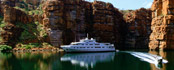
Further on is the Caroline Pool, another popular local swimming spot, which is reminiscent of the gorges along the MacDonnell Ranges in Australia’s centre. The river comes between two cliffs forming a deep pool in the gorge.
 Towns
Towns Attractions
 Hotels